
Services

-
Cinematic Aerial Footage – High-quality drone shots for marketing, events, and cinematic projects.
Real Estate Marketing – Aerial and ground-level videography/photography to showcase properties.
-
Aerial Mapping & 3D Scanning – High-resolution maps, 3D models, and photogrammetry for orthomosaic land surveys and construction planning.
Inspections & Surveys – Drone-based inspections for roofs, infrastructure, and industrial sites, reducing risk and improving efficiency.
-
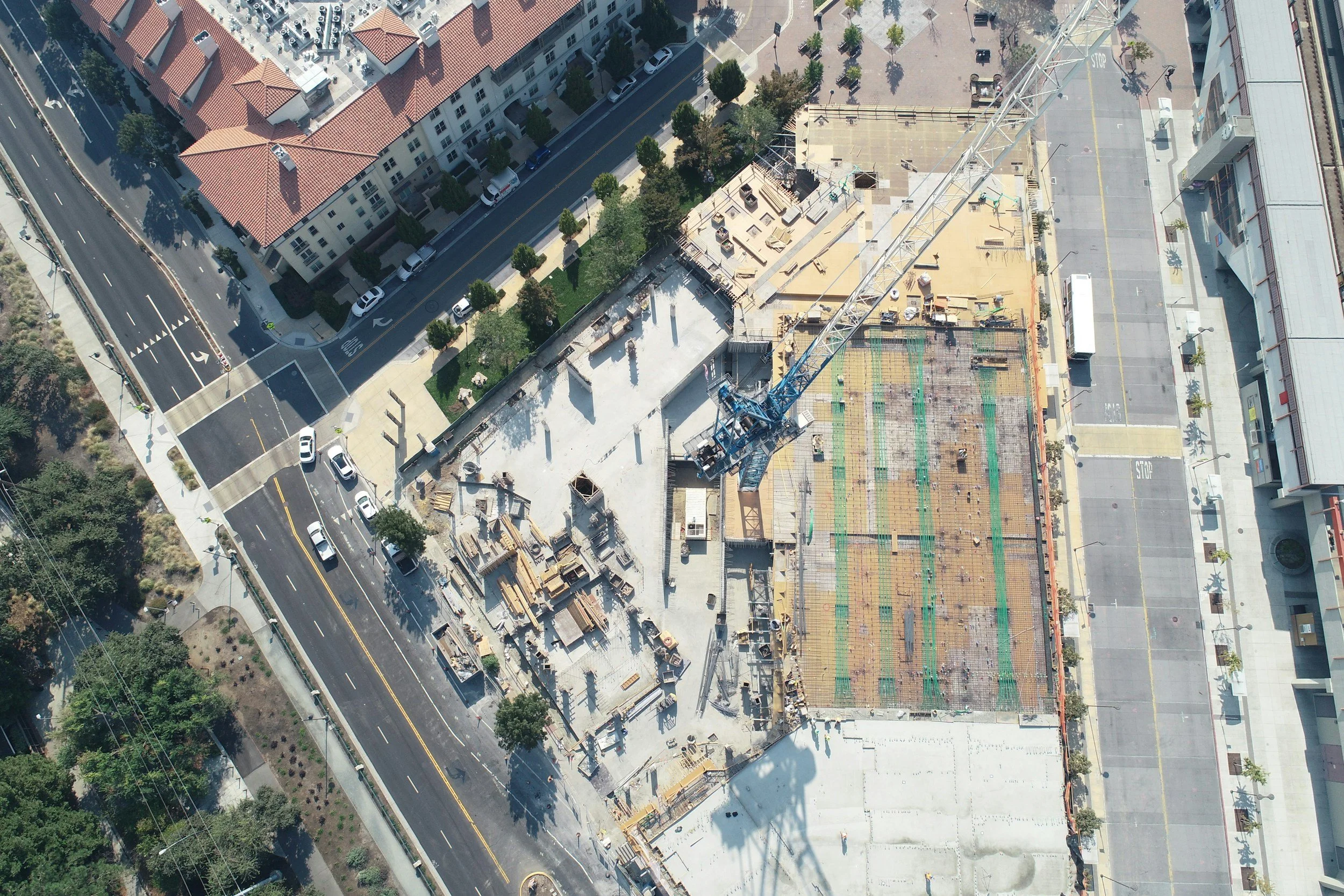
Progress Monitoring & Time-Lapse – Regular aerial and ground-based updates to track site progress.
Construction Documentation – High-resolution imagery and video for compliance, stakeholder updates, and marketing.
-
Social Media & Lifestyle Content – Professional videography and photography for personal brands, influencers, small businesses, and keepsakes.
Marketing & Promotional Videos – Engaging content tailored for businesses, events, and social media campaigns.

Aerial & Ground
Videography & Photography
Capture properties and projects with professional-grade visuals tailored to your needs.
Standard Package – High-resolution HDR photography and floor plans, ideal for listings requiring a polished yet budget-friendly presentation.
Enhanced Package – Upgraded visuals, including cinematic videography and aerial drone capture, perfect for high-end properties and premium marketing.
Signature Package – A full-scale production featuring luxury-level videography, immersive 360° virtual tours, and strategic editing designed to captivate buyers and investors.
Best for: Real estate marketing, architectural showcases, and commercial property presentations.
Technical Drone Inspections
& 3D Mapping
Deliver precise, data-driven insights with cutting-edge drone technology.
Visual Inspection – High-resolution aerial imaging for quick site evaluations and visual inspections.
Precision mapping – 3D mapping, photogrammetry, and detailed orthomosaic imaging for project planning and construction monitoring.
Comprehensive Analysis – Thermal imaging, structural assessments, and full-scale data reporting for in-depth inspections and facility management.
Best for: Construction monitoring, site planning, property maintenance, and insurance assessments.

Project Documentation
& Immersive Media
Keep stakeholders informed and engaged with dynamic visual storytelling.
Foundational Package – Essential time-lapse and periodic progress photography to document key project milestones.
Expanded Coverage – Aerial videography, 360° virtual tours, and customized progress reporting to enhance project transparency.
Executive-Level Documentation – High-end cinematic storytelling with branded video content, investor-ready reports, and immersive media for stakeholder engagement.
Best for: Developers, architects, facility managers, and real estate investors.
Contact for ESTIMATE
Serving Chicagoland, Southeast Wisconsin, Northwest Indiana, and Central Illinois
Thorough scoping and guaranteed pricing before work begins.
Insured for Commercial Drone Operations
FAA Part 107 Certified